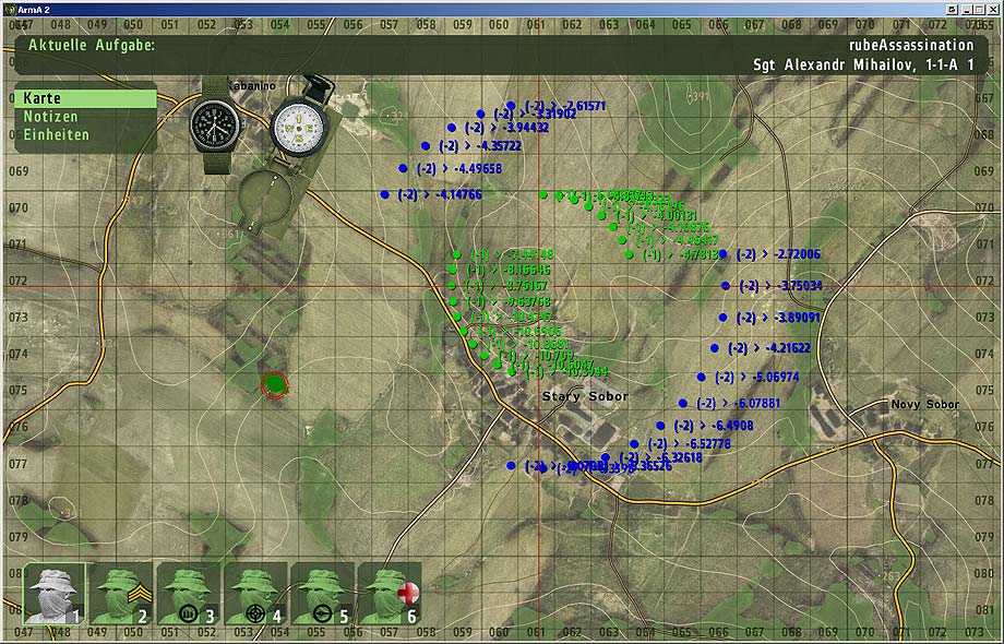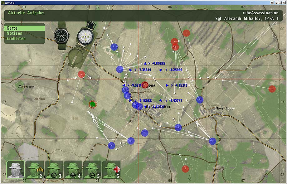
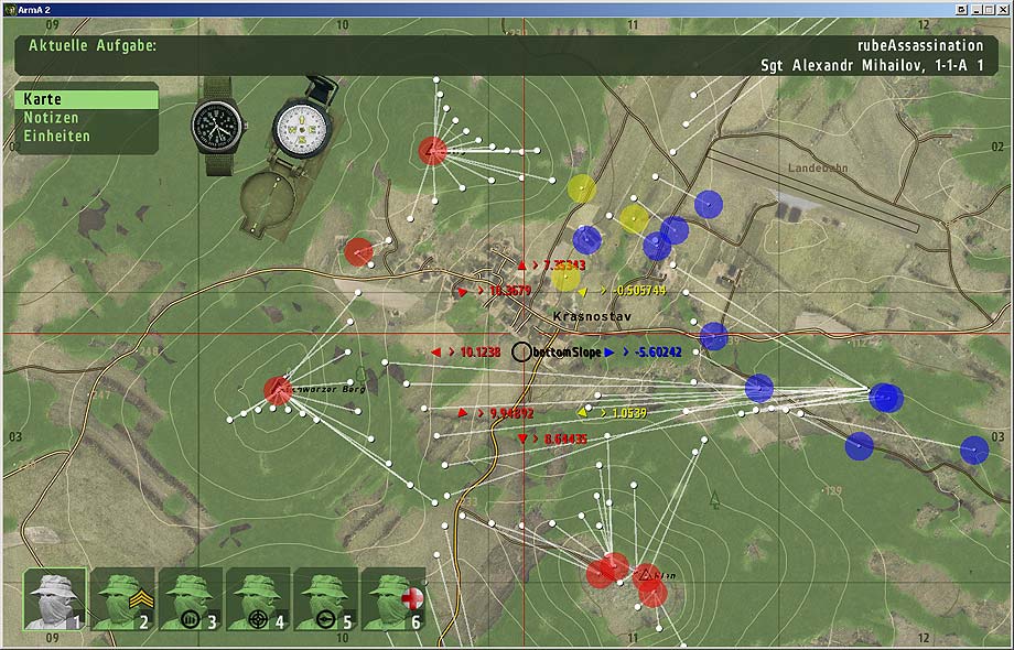
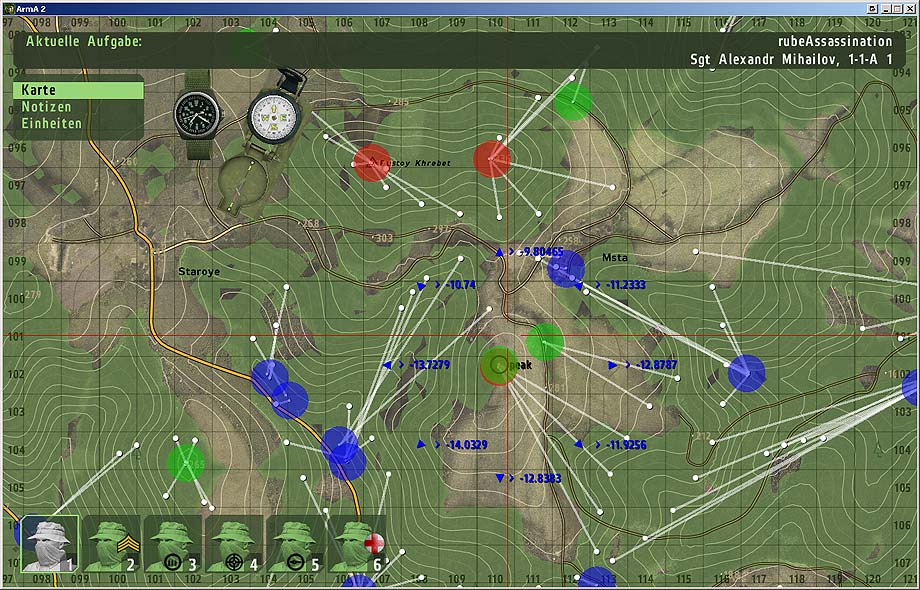
Demonstration of RUBE_samplePeriphery (first shot) and RUBE_analyzePeriphery (second shot), tracing the terrain to gain information about the periphery of a given position.
The basic idea is to shoot rays away from (and to) the given position, following the terrain until the current "trend" stops. E.g. once reached the top of a hill or the bottom, etc.
Then we may merge these endpositions if too close to each other to identify a major topographical feature such as a hill, etc (we could even weight them, according to how many sample-rays ended up there...). "Firing" rays to the sampling position (instead of away from there) is essential to gain a self-aware classification. Are we on a hilltop or at the bottom of a valley? Also we may compute the average gradient for each directions. (see screenshots to the right)
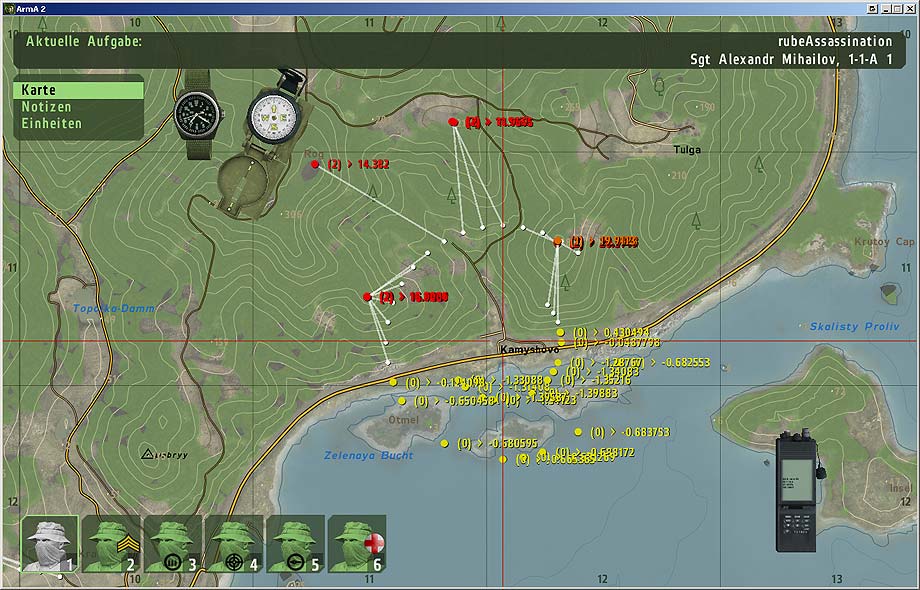
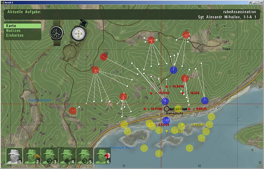
Kamyshovo:
Krasnastav: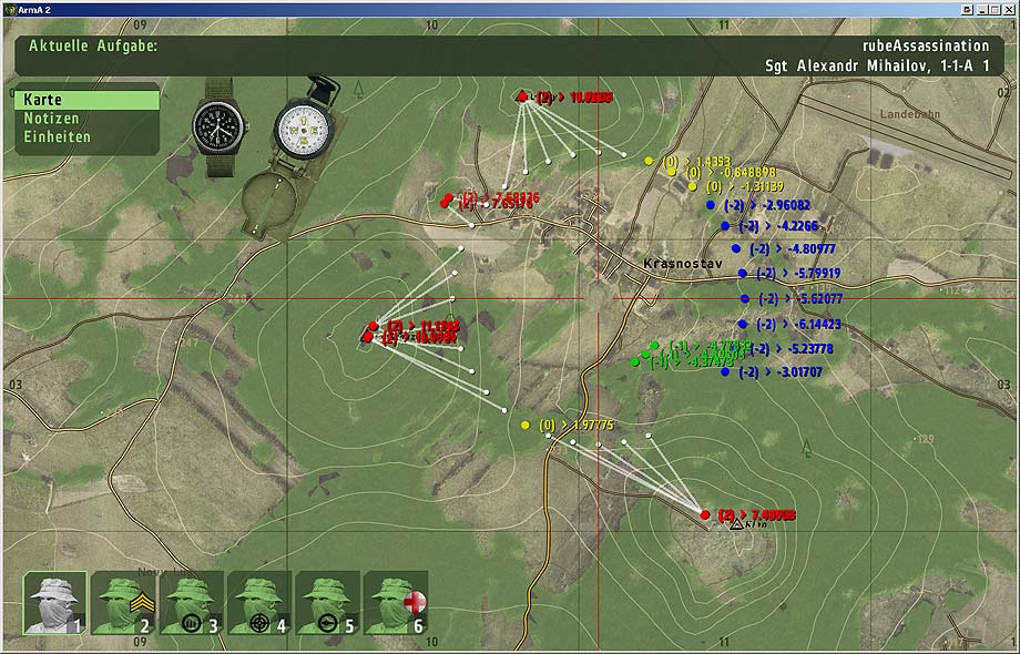
Msta: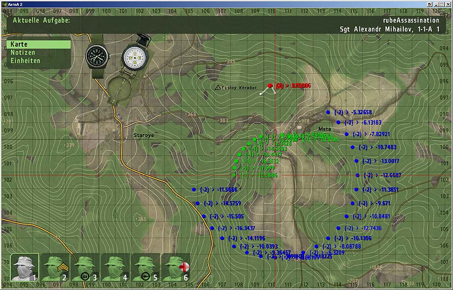
Stary Sobor: